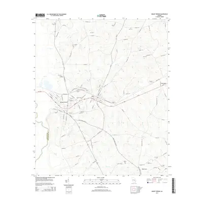
2014 Map of Mount Vernon
USGS Topo · Published 2014About this map
Mount Vernon and its adjacent neighbor Ailey serve as the focal points of this South Georgia landscape, where the campus of Brewton-Parker Coll stands near the intersection of several regional routes. The map documents the local geography at the Montgomery and Wheeler county line, defined by the winding paths of Bear Cr, Limestone Cr, and Lotts Cr. A network of rural roads and family-named landmarks reflects the area's agricultural and social history, with several burial grounds such as McRae Cemeteries and Grove Sharpe Cem scattered throughout the countryside. The presence of the N Railroad Ave corridor highlights the historical importance of the rail line to these small timber and farming communities. Outlying settlements like McGregor and Oak Grove are also mapped, providing a clear picture of the residential distribution across the drainage basins of Cypress Br and Oconee Cr.
Find a feature on this map
101 named features on this map. Tap any name to fly to it.
Don’t see what you’re looking for? This feature index may not catch every label — zoom into the map to look around manually.
Map Details
Editions of this 2014 Mount Vernon Map
This is the sole edition of this map. No revisions or reprints were ever made.
Other maps of this area

1957 · Macon
USGS Topo · 1:250,000

1958 · Macon
USGS Topo · 1:250,000

1964 · Macon
USGS Topo · 1:250,000

1970 · Glenwood
USGS Topo · 1:24,000

1970 · Alston
USGS Topo · 1:24,000

1970 · Oak Park SW
USGS Topo · 1:24,000

1970 · Mount Vernon
USGS Topo · 1:24,000

1970 · Vidalia
USGS Topo · 1:24,000

1970 · Uvalda
USGS Topo · 1:24,000

1970 · Jordan
USGS Topo · 1:24,000