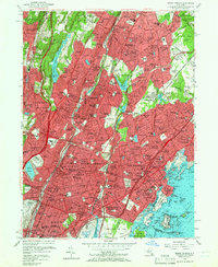
1956 Map of Mount Vernon
USGS Topo · Published 1965About this map
Yonkers Raceway and the St Josephs Seminary dominate the western landscape of this mid-century Westchester County survey. The map reveals an intensely developed suburban corridor defined by major parkway systems including the Bronx River Parkway and the Hutchinson River Parkway. This era showcases the post-war expansion of residential neighborhoods like Crestwood Gardens and Heath Ridge, while preserving extensive recreational grounds such as Saxon Woods Park and numerous private clubs. Along the Long Island Sound, the coastline is a hive of maritime activity, featuring the Larchmont Yacht Club and the U S Mil Res Fort Slocum on David Island. The dense network of public schools, including PS 103 and Greenville Sch, alongside religious institutions like Iona College, provides a detailed look at the social infrastructure supporting the booming population of Mount Vernon and Yonkers during the 1950s.
Find a feature on this map
226 named features on this map. Tap any name to fly to it.
Don’t see what you’re looking for? This feature index may not catch every label — zoom into the map to look around manually.
Map Details
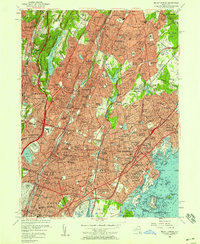
Editions of this 1956 Mount Vernon Map
2 editions found
Other maps of this area

1891 · Harlem
USGS Topo · 1:62,500

1892 · Stamford
USGS Topo · 1:62,500

1892 · Tarrytown
USGS Topo · 1:62,500

1893 · Stamford
USGS Topo · 1:62,500

1893 · Tarrytown
USGS Topo · 1:62,500

1897 · Harlem
USGS Topo · 1:62,500

1897 · Oyster Bay
USGS Topo · 1:62,500

1898 · Harlem
USGS Topo · 1:62,500

1898 · Oyster Bay
USGS Topo · 1:62,500

1899 · Stamford
USGS Topo · 1:62,500