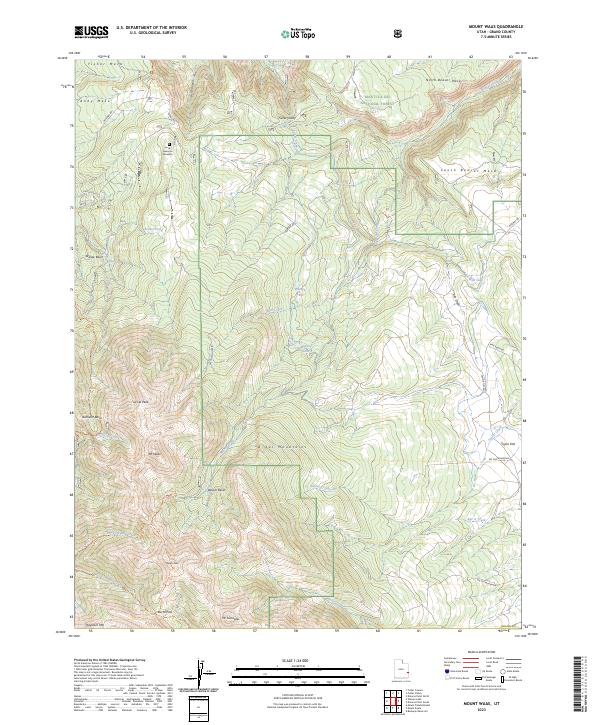
2023 Map of Mount Waas
USGS Topo · Published 2023About this map
The high peaks of the La Sal Mountains dominate this landscape, where steep canyons and flat-topped mesas create a dramatic vertical profile in Grand County. This modern survey details the rugged alpine environment surrounding Mt Waas and Manns Peak, showing the complex drainage systems of Beaver Creek and Fisher Creek. High-elevation features like Burro Pass and the Bachelor Basin are clearly delineated alongside the primary routes through the backcountry, including Castleton RD and Taylor Flat RD.
Find a feature on this map
44 named features on this map. Tap any name to fly to it.
Don’t see what you’re looking for? This feature index may not catch every label — zoom into the map to look around manually.
Map Details
Editions of this 2023 Mount Waas Map
This is the sole edition of this map. No revisions or reprints were ever made.
Other maps of this area

1885 · La Sal
USGS Topo · 1:250,000

1954 · Mt Peale 1 NE
USGS Topo · 1:24,000

1954 · Mt. Waas 4 SE
USGS Topo · 1:24,000

1954 · Mt. Waas 4 SW
USGS Topo · 1:24,000

1954 · Mt. Waas 4 NE
USGS Topo · 1:24,000

1954 · Mt. Waas 4 NW
USGS Topo · 1:24,000

1954 · Mt Peale 1 NW
USGS Topo · 1:24,000

1954 · Mt. Waas 3 NE
USGS Topo · 1:24,000

1954 · Mt. Waas 3 SE
USGS Topo · 1:24,000

1954 · Mt Peale 2 NE
USGS Topo · 1:24,000