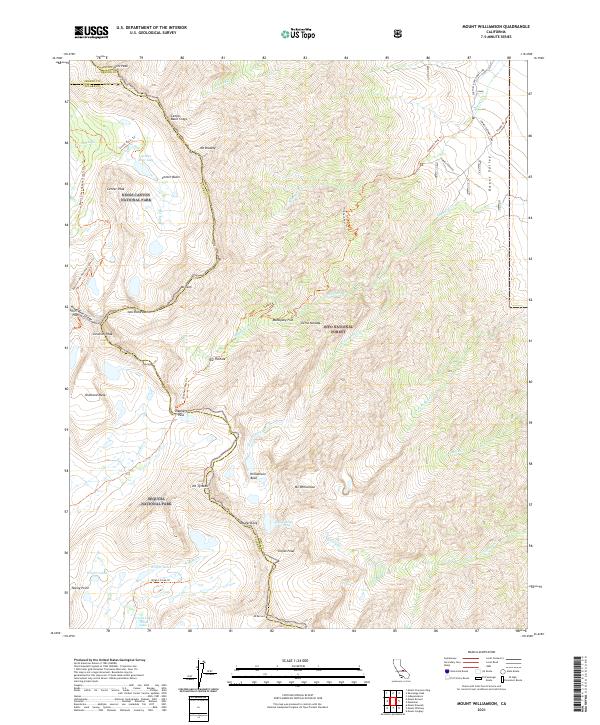
2021 Map of Mount Williamson
USGS Topo · Published 2021About this map
Sierra Nevada peaks and high-altitude alpine basins dominate this 2021 survey, centered on the massive granite profile of Mt Williamson. This topographical study covers the intersection of three major protected areas: Kings Canyon National Park, Inyo National Forest, and Sequoia National Park. The landscape is defined by its extreme elevation changes, from the floor of the Owens Valley up to the high crests of Mt Tyndall and Mt Keith. Hikers and mountaineers can trace the route of the Pacific Crest National Scenic Trl as it traverses the western edge, along with the challenging ascent of the Shepherd Pass Trl. Notable water features including Lake Helen of Troy, the Wright Lakes, and Golden Bear Lake illustrate the glacial drainage patterns that feed into Symmes Cr and Williamson Cr.
Find a feature on this map
54 named features on this map. Tap any name to fly to it.
Don’t see what you’re looking for? This feature index may not catch every label — zoom into the map to look around manually.
Map Details
Editions of this 2021 Mount Williamson Map
This is the sole edition of this map. No revisions or reprints were ever made.
Other maps of this area

1907 · Mt. Whitney
USGS Topo · 1:125,000

1919 · Mt. Whitney
USGS Topo · 1:125,000

1937 · Mt. Whitney
USGS Topo · 1:125,000

1948 · Fresno
USGS Topo · 1:250,000

1951 · Independence
USGS Topo · 1:62,500

1953 · Mt. Pinchot
USGS Topo · 1:62,500

1955 · Fresno
USGS Topo · 1:250,000

1956 · Fresno
USGS Topo · 1:250,000

1956 · Mount Whitney
USGS Topo · 1:62,500

1958 · Fresno
USGS Topo · 1:250,000