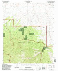
1995 Map of Mount Withington
USGS Topo · Published 1998About this map
The San Mateo Mountains dominate this high-altitude landscape within the Cibola National Forest, showing a network of canyons and peaks as they appeared in the mid-1990s. The terrain is characterized by steep elevation changes, rising to its highest point at Mount Withington, which is marked by Lookout 10115. Human presence in this remote area is documented through scattered landmarks such as the Monica Cabin and infrastructure related to livestock or forestry, including Boundary Tank, Cooney Windmill, and a Corral.
Find a feature on this map
34 named features on this map. Tap any name to fly to it.
Don’t see what you’re looking for? This feature index may not catch every label — zoom into the map to look around manually.
Map Details
Editions of this 1995 Mount Withington Map
This is the sole edition of this map. No revisions or reprints were ever made.
Other maps of this area

1954 · Tularosa
USGS Topo · 1:250,000

1954 · Socorro
USGS Topo · 1:250,000

1958 · Socorro
USGS Topo · 1:250,000

1958 · Tularosa
USGS Topo · 1:250,000

1962 · Socorro
USGS Topo · 1:250,000

1963 · Arroyo Landavaso
USGS Topo · 1:24,000

1964 · Arrowhead Well
USGS Topo · 1:24,000

1964 · Bay Buck Peaks
USGS Topo · 1:24,000
1964 · Grassy Lookout
USGS Topo · 1:24,000

1964 · Monica Saddle
USGS Topo · 1:24,000