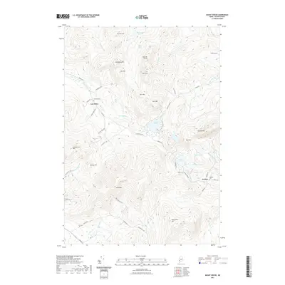
2021 Map of Mount Zircon
USGS Topo · Published 2021About this map
Mt Zircon and its namesake reservoir dominate the northern reaches of this Oxford County landscape, where the peaks of Hemingway Mtn and Speckled Mtn overlook a complex network of brooks and ponds. The small settlements of East Milton and Redding serve as focal points for local history, connected by a web of mountain roads including Concord Pond Rd and Redding Rd. Genealogists will find several family-named burial sites, such as Greenleaf Cem and Robbins Cem, which are tucked away near the headwaters of the W Br Nezinscot River. The terrain is defined by its water resources, from the isolated Shagg Pond and Abbotts Pond to the winding course of the Concord River, illustrating a pattern of upland Maine settlement concentrated along valley floors and spring sites like Mount Zircon Spring.
Find a feature on this map
59 named features on this map. Tap any name to fly to it.
Don’t see what you’re looking for? This feature index may not catch every label — zoom into the map to look around manually.
Map Details
Editions of this 2021 Mount Zircon Map
This is the sole edition of this map. No revisions or reprints were ever made.
Other maps of this area

1911 · Bryant Pond
USGS Topo · 1:62,500

1911 · Buckfield
USGS Topo · 1:62,500

1913 · Buckfield
USGS Topo · 1:62,500

1914 · Bryant Pond
USGS Topo · 1:62,500

1926 · Dixfield
USGS Topo · 1:62,500

1927 · Rumford
USGS Topo · 1:48,000

1929 · Dixfield
USGS Topo · 1:62,500

1930 · Rumford
USGS Topo · 1:62,500

1942 · Buckfield
USGS Topo · 1:62,500

1942 · Bryant Pond
USGS Topo · 1:62,500