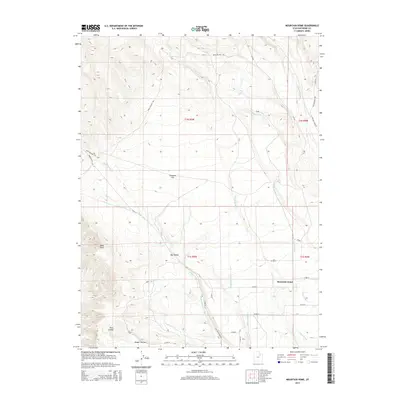
2014 Map of Mountain Home
USGS Topo · Published 2014About this map
The settlement of Mountain Home serves as the focal point for this section of Duchesne County, where the high desert terrain meets an intricate network of irrigation and natural drainage. The landscape is defined by its dramatic relief, featuring prominent landmarks like Bald Knoll and the Twin Knolls, as well as the deep erosional cuts of Big Hollow and Draper Hollow. Water management is central to the area's geography, with the Lake Fork River and Pigeon Water Cr supplemented by human-made infrastructure like the Farnsworth Canal and several numbered laterals. This intersection of natural watercourses and irrigation canals across the Towanta Flat illustrates the region's reliance on hydraulic engineering to support its rural character. A grid of county roads, such as Bear Hollow Rd and Yellowstone Rd, provides access across the shifting elevations from the heights of Bear Hollow down to the valley floors.
Find a feature on this map
30 named features on this map. Tap any name to fly to it.
Don’t see what you’re looking for? This feature index may not catch every label — zoom into the map to look around manually.
Map Details
Editions of this 2014 Mountain Home Map
This is the sole edition of this map. No revisions or reprints were ever made.
Other maps of this area

1885 · Uinta
USGS Topo · 1:250,000

1901 · Hayden Peak
USGS Topo · 1:125,000

1903 · Hayden Peak
USGS Topo · 1:125,000

1905 · Gilbert Peak
USGS Topo · 1:125,000

1906 · Gilbert Peak
USGS Topo · 1:125,000

1939 · Duchesne
USGS Topo · 1:125,000

1954 · Salt Lake City
USGS Topo · 1:250,000

1958 · Salt Lake City
USGS Topo · 1:250,000

1960 · Salt Lake City
USGS Topo · 1:250,000

1962 · Blacktail Mtn
USGS Topo · 1:24,000