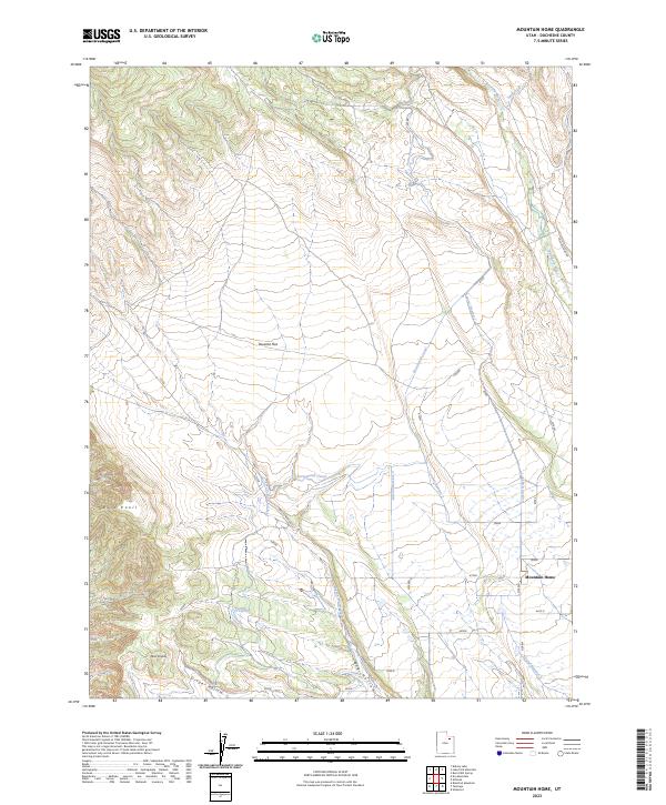
2023 Map of Mountain Home
USGS Topo · Published 2023About this map
The high plains of Duchesne County are defined by a complex irrigation network, where the Farnsworth Canal and multiple laterals, including Lateral Number 1, distribute water across the arid landscape. The small settlement of Mountain Home serves as a local hub near the eastern edge of the quadrangle, situated just west of the Lake Fork River. The terrain transitions from the broad expanse of Towanta Flat to more varied topography in the south, characterized by prominent features like Bald Knoll and the Twin Knolls. The presence of several named waterways such as Salt Creek and Pigeon Water Creek illustrates the vital role of water management for life in this part of Utah. Tracing Rock Creek Rd and Yellow Stone Rd reveals the primary transit routes connecting the scattered homesteads and ranches that rely on the moisture channeled through the canal system into areas like Draper Hollow.
Find a feature on this map
15 named features on this map. Tap any name to fly to it.
Don’t see what you’re looking for? This feature index may not catch every label — zoom into the map to look around manually.
Map Details
Editions of this 2023 Mountain Home Map
This is the sole edition of this map. No revisions or reprints were ever made.
Other maps of this area

1885 · Uinta
USGS Topo · 1:250,000

1901 · Hayden Peak
USGS Topo · 1:125,000

1903 · Hayden Peak
USGS Topo · 1:125,000

1905 · Gilbert Peak
USGS Topo · 1:125,000

1906 · Gilbert Peak
USGS Topo · 1:125,000

1939 · Duchesne
USGS Topo · 1:125,000

1954 · Salt Lake City
USGS Topo · 1:250,000

1958 · Salt Lake City
USGS Topo · 1:250,000

1960 · Salt Lake City
USGS Topo · 1:250,000

1962 · Blacktail Mtn
USGS Topo · 1:24,000