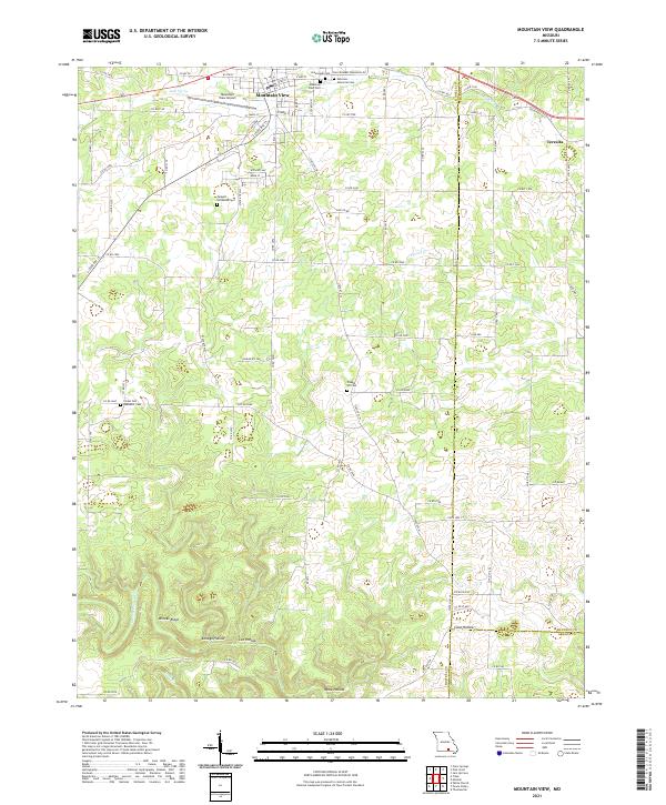
2021 Map of Mountain View
USGS Topo · Published 2021About this map
Mountain View serves as the primary hub of activity in this Ozark landscape, where the intersection of S State Rte 17 and Old Hwy 60 anchors the town's grid. The area is characterized by a series of named hollows, including Kenaga Hollow, Lee Hollow, and Cane Hollow, which drain toward the southern reaches of the Eleven Point River. To the northeast, the smaller settlement of Teresita marks a quiet pocket near the Shannon County line.
Find a feature on this map
83 named features on this map. Tap any name to fly to it.
Don’t see what you’re looking for? This feature index may not catch every label — zoom into the map to look around manually.
Map Details
Editions of this 2021 Mountain View Map
This is the sole edition of this map. No revisions or reprints were ever made.
Other maps of this area

1945 · Willow Springs
USGS Topo · 1:62,500

1945 · Montier
USGS Topo · 1:62,500

1945 · Clear Springs
USGS Topo · 1:62,500

1946 · Summersville
USGS Topo · 1:62,500

1948 · Clear Springs
USGS Topo · 1:62,500

1948 · Montier
USGS Topo · 1:62,500

1948 · Willow Springs
USGS Topo · 1:62,500

1948 · Summersville
USGS Topo · 1:62,500

1949 · Rolla
USGS Topo · 1:250,000

1953 · Rolla
USGS Topo · 1:250,000