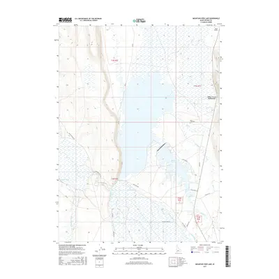
2017 Map of Mountain View Lake
USGS Topo · Published 2017About this map
Duck Valley and the Miller Creek Settlement define this arid landscape near the Idaho-Nevada border. This 2017 survey reveals an intricate network of water management, where the Owyhee River and Blue Creek support local agriculture through features like the Main Canal, Agency Canal, and White Rock Lateral. These man-made diversions contrast with the natural flow of Thacker Slough and Billy Shaw Slough, illustrating the importance of irrigation in Owyhee County. Local history is anchored by the Miller Creek Cem, located south of the main settlement area near Bell Cr. Significant water bodies including Mountain View Lake and the Boyle Cr Reservoir provide essential landmarks in a region largely navigated by Bureau of Indian Affairs routes such as 902 Bia and 211 Bia.
Find a feature on this map
36 named features on this map. Tap any name to fly to it.
Don’t see what you’re looking for? This feature index may not catch every label — zoom into the map to look around manually.
Map Details
Editions of this 2017 Mountain View Lake Map
This is the sole edition of this map. No revisions or reprints were ever made.
Other maps of this area

1939 · Owyhee
USGS Topo · 1:62,500

1942 · Owyhee
USGS Topo · 1:62,500

1955 · McDermitt
USGS Topo · 1:250,000

1955 · Jordan Valley
USGS Topo · 1:250,000

1957 · Jordan Valley
USGS Topo · 1:250,000

1958 · Jordan Valley
USGS Topo · 1:250,000

1959 · McDermitt
USGS Topo · 1:250,000

1964 · Hat Peak
USGS Topo · 1:62,500

1971 · Juniper Basin SE
USGS Topo · 1:24,000
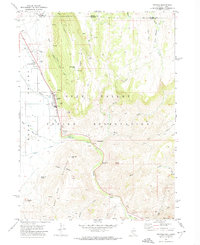
1971 · Owyhee
USGS Topo · 1:24,000