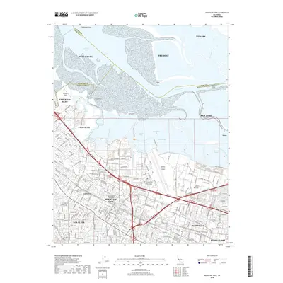
2018 Map of Mountain View
USGS Topo · Published 2018About this map
The southern reaches of San Francisco Bay meet the tech corridors of the Silicon Valley in this detailed 2018 survey. The landscape is defined by the complex transition from the urban centers of Mountain View, Sunnyvale, and Palo Alto to the tidal wetlands of Crittenden Marsh and Charleston Slough. At the heart of the map lies the massive footprint of Moffett Federal Airfield, flanked by modern academic and industrial anchors like the Carnegie Mellon University Silicon Valley Campus and Cogswell Polytechnical College. This edition captures the high-density street grids of neighborhoods like Castro City and the historic waterfront character of Alviso. Regional infrastructure is prominently displayed, from the South Hetchy Aqueduct to the extensive network of recreational paths including the Smart Station Trail and Adobe Creek Loop Trail.
Find a feature on this map
52 named features on this map. Tap any name to fly to it.
Don’t see what you’re looking for? This feature index may not catch every label — zoom into the map to look around manually.
Map Details
Editions of this 2018 Mountain View Map
This is the sole edition of this map. No revisions or reprints were ever made.
Other maps of this area

1889 · San Jose
USGS Topo · 1:62,500

1897 · San Jose
USGS Topo · 1:62,500

1897 · Palo Alto
USGS Topo · 1:62,500

1899 · San Jose
USGS Topo · 1:62,500

1899 · Palo Alto
USGS Topo · 1:62,500

1899 · Haywards
USGS Topo · 1:62,500

1902 · Santa Cruz
USGS Topo · 1:125,000

1906 · Pleasanton
USGS Topo · 1:62,500

1915 · Haywards
USGS Topo · 1:62,500

1941 · Pleasanton
USGS Topo · 1:62,500