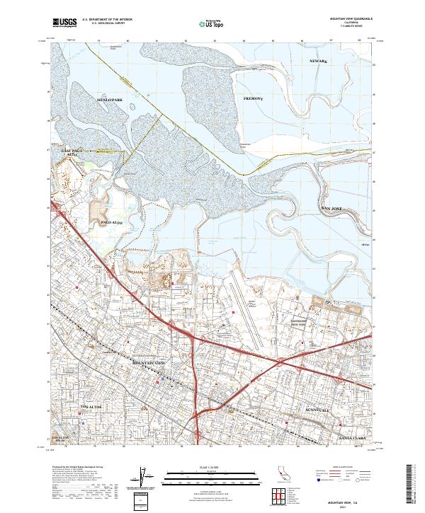
2021 Map of Mountain View
USGS Topo · Published 2021About this map
Moffett Federal Airfield and the sprawling tech campuses of the Silicon Valley define this 2021 landscape at the southern end of San Francisco Bay. The map documents a complex interface between dense urban development and the natural salt marshes of the South Bay, including Mountain View Tidal Marsh and Crittenden Marsh. Large-scale infrastructure like the Hetch Hetchy Aqueduct and the Caltrain corridor support the interconnected cities of Mountain View, Palo Alto, and Sunnyvale.
Find a feature on this map
259 named features on this map. Tap any name to fly to it.
Don’t see what you’re looking for? This feature index may not catch every label — zoom into the map to look around manually.
Map Details
Editions of this 2021 Mountain View Map
This is the sole edition of this map. No revisions or reprints were ever made.
Other maps of this area

1889 · San Jose
USGS Topo · 1:62,500

1897 · San Jose
USGS Topo · 1:62,500

1897 · Palo Alto
USGS Topo · 1:62,500

1899 · San Jose
USGS Topo · 1:62,500

1899 · Palo Alto
USGS Topo · 1:62,500

1899 · Haywards
USGS Topo · 1:62,500

1902 · Santa Cruz
USGS Topo · 1:125,000

1906 · Pleasanton
USGS Topo · 1:62,500

1915 · Haywards
USGS Topo · 1:62,500

1941 · Pleasanton
USGS Topo · 1:62,500