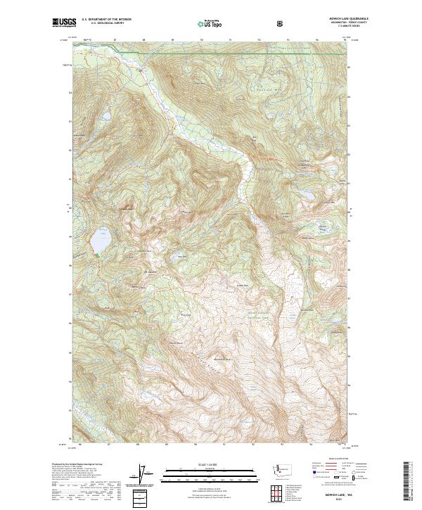
2023 Map of Mowich Lake
USGS Topo · Published 2023About this map
Mowich Lake and the high glaciated reaches of Mount Rainier National Park define this landscape within the Mount Rainier Wilderness. The map reveals a complex network of glacial activity and alpine drainages, including the massive Carbon Glacier and the high-elevation Flett Glacier. This modern survey tracks the established backcountry routes such as the Wonderland Trl and the Northern Loop Trl, which connect notable landmarks like Ipsut Pass and Windy Gap. The presence of dramatic terrain features like Mother Mtn, the Sluiskin Mountains, and the Northern Crags illustrates the severe verticality of the northwest corner of the park. From the valley floors of the North Mowich River to the subalpine meadows of Spray Park and Mist Park, the map serves as a contemporary guide to the region's wilderness character and glacial hydrology.
Find a feature on this map
101 named features on this map. Tap any name to fly to it.
Don’t see what you’re looking for? This feature index may not catch every label — zoom into the map to look around manually.
Map Details
Editions of this 2023 Mowich Lake Map
This is the sole edition of this map. No revisions or reprints were ever made.
Other maps of this area

1913 · Cedar Lake
USGS Topo · 1:125,000

1924 · Mt Rainier
USGS Topo · 1:96,000

1928 · Mt Rainier
USGS Topo · 1:125,000

1950 · Yakima
USGS Topo · 1:250,000

1956 · Greenwater
USGS Topo · 1:62,500

1956 · Enumclaw
USGS Topo · 1:62,500

1957 · Wenatchee
USGS Topo · 1:250,000

1958 · Yakima
USGS Topo · 1:250,000

1961 · Yakima
USGS Topo · 1:250,000
1971 · Sunrise
USGS Topo · 1:24,000