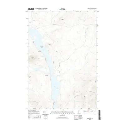
2014 Map of Moxie Pond
USGS Topo · Published 2014About this map
Troutdale serves as the primary point of settlement on this Maine landscape, situated along the western edge of Moxie Pond. The topography is dominated by significant elevations and water bodies, including the prominent peaks of Mosquito Mtn and Bald Mtn. A network of logging and access roads like Shirley Tote Rd and Troutdale Rd navigate the steep terrain, while the Appalachian National Scenic Trail traverses the southern reaches of the quadrangle.
Find a feature on this map
28 named features on this map. Tap any name to fly to it.
Don’t see what you’re looking for? This feature index may not catch every label — zoom into the map to look around manually.
Map Details
Editions of this 2014 Moxie Pond Map
This is the sole edition of this map. No revisions or reprints were ever made.
Other maps of this area

1903 · Bingham
USGS Topo · 1:62,500

1905 · Bingham
USGS Topo · 1:62,500

1905 · The Forks
USGS Topo · 1:62,500

1907 · The Forks
USGS Topo · 1:62,500

1948 · Kingsbury
USGS Topo · 1:62,500

1950 · Kingsbury
USGS Topo · 1:62,500

1951 · Greenville
USGS Topo · 1:62,500

1954 · Millinocket
USGS Topo · 1:250,000

1956 · The Forks
USGS Topo · 1:62,500

1956 · Bingham
USGS Topo · 1:62,500