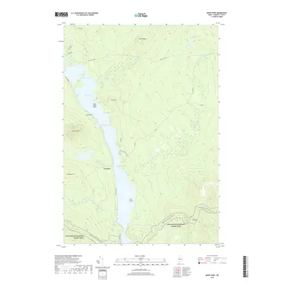
2018 Map of Moxie Pond
USGS Topo · Published 2018About this map
Troutdale sits along the western shore of the long, narrow waters of Moxie Pond, serving as a primary point of human settlement in this heavily wooded landscape of Somerset County. The terrain is defined by dramatic elevation changes, notably at Mosquito Mtn and Bald Mtn, which frame the water-carved valley. The Appalachian National Scenic Trail winds through the southern portion of the map, crossing Bald Mountain Brook and climbing the ridges above the water. A network of primitive roads and traditional pathways, such as Shirley Tote Rd and York Rd, suggests a history of timber management and remote access. The lake itself is divided by geographical features like the Black Narrows and Mosquito Narrows, while Burnt Jacket Island and Pine Island provide distinct landmarks within the basin.
Find a feature on this map
33 named features on this map. Tap any name to fly to it.
Don’t see what you’re looking for? This feature index may not catch every label — zoom into the map to look around manually.
Map Details
Editions of this 2018 Moxie Pond Map
This is the sole edition of this map. No revisions or reprints were ever made.
Other maps of this area

1903 · Bingham
USGS Topo · 1:62,500

1905 · Bingham
USGS Topo · 1:62,500

1905 · The Forks
USGS Topo · 1:62,500

1907 · The Forks
USGS Topo · 1:62,500

1948 · Kingsbury
USGS Topo · 1:62,500

1950 · Kingsbury
USGS Topo · 1:62,500

1951 · Greenville
USGS Topo · 1:62,500

1954 · Millinocket
USGS Topo · 1:250,000

1956 · The Forks
USGS Topo · 1:62,500

1956 · Bingham
USGS Topo · 1:62,500