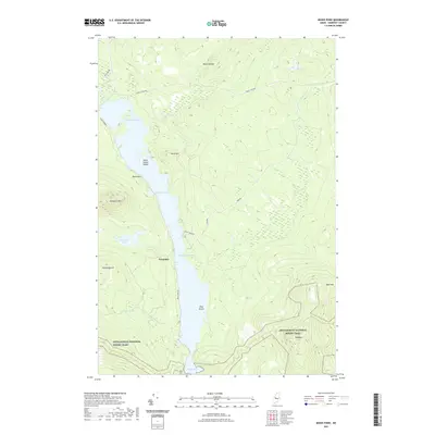
2021 Map of Moxie Pond
USGS Topo · Published 2021About this map
Troutdale sits along the western shore of the long, slender waters of Moxie Pond in this modern topographical survey of Somerset County. The landscape is defined by its dramatic elevation changes and significant water bodies, featuring tight constrictions like the Caribou Narrows, Black Narrows, and Mosquito Narrows. These natural bottlenecks and islands such as Burnt Jacket Island and Pine Island create a complex shoreline that has long influenced local navigation and settlement patterns.
Find a feature on this map
25 named features on this map. Tap any name to fly to it.
Don’t see what you’re looking for? This feature index may not catch every label — zoom into the map to look around manually.
Map Details
Editions of this 2021 Moxie Pond Map
This is the sole edition of this map. No revisions or reprints were ever made.
Other maps of this area

1903 · Bingham
USGS Topo · 1:62,500

1905 · Bingham
USGS Topo · 1:62,500

1905 · The Forks
USGS Topo · 1:62,500

1907 · The Forks
USGS Topo · 1:62,500

1948 · Kingsbury
USGS Topo · 1:62,500

1950 · Kingsbury
USGS Topo · 1:62,500

1951 · Greenville
USGS Topo · 1:62,500

1954 · Millinocket
USGS Topo · 1:250,000

1956 · The Forks
USGS Topo · 1:62,500

1956 · Bingham
USGS Topo · 1:62,500