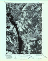
1977 Map of Moxie Pond
USGS Topo · Published 1981About this map
Moxie Pond anchors the central valley of this Somerset County landscape, its long, slender waters cutting through the heavily forested terrain of north-central Maine. The small settlement of Troutdale sits on the western shore, positioned where the lake narrows and providing a rare point of habitation in an otherwise undeveloped timberland. This orthophotograph, captured in late 1977, reveals the sharp textures of the woods and the cleared swaths that suggest active forest management during this era.
Find a feature on this map
7 named features on this map. Tap any name to fly to it.
Don’t see what you’re looking for? This feature index may not catch every label — zoom into the map to look around manually.
Map Details
Editions of this 1977 Moxie Pond Map
This is the sole edition of this map. No revisions or reprints were ever made.
Other maps of this area

1903 · Bingham
USGS Topo · 1:62,500

1905 · Bingham
USGS Topo · 1:62,500

1905 · The Forks
USGS Topo · 1:62,500

1907 · The Forks
USGS Topo · 1:62,500

1948 · Kingsbury
USGS Topo · 1:62,500

1950 · Kingsbury
USGS Topo · 1:62,500

1951 · Greenville
USGS Topo · 1:62,500

1954 · Millinocket
USGS Topo · 1:250,000

1956 · The Forks
USGS Topo · 1:62,500

1956 · Bingham
USGS Topo · 1:62,500