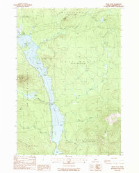
1988 Map of Moxie Pond
USGS Topo · Published 1988About this map
Moxie Pond dominates the center of this Maine backcountry landscape, its elongated waters pinched by the Caribou Narrows, Black Narrows, and Mosquito Narrows. The small settlement of Troutdale sits on the western shore, serving as a point of contact along the rail line that skirts the water's edge. This 1980s provisional study records the rugged topography of Somerset County before major modern changes, noting prominent peaks like Mosquito Mountain and Black Nubble.
Find a feature on this map
32 named features on this map. Tap any name to fly to it.
Don’t see what you’re looking for? This feature index may not catch every label — zoom into the map to look around manually.
Map Details
Editions of this 1988 Moxie Pond Map
This is the sole edition of this map. No revisions or reprints were ever made.
Other maps of this area

1903 · Bingham
USGS Topo · 1:62,500

1905 · Bingham
USGS Topo · 1:62,500

1905 · The Forks
USGS Topo · 1:62,500

1907 · The Forks
USGS Topo · 1:62,500

1948 · Kingsbury
USGS Topo · 1:62,500

1950 · Kingsbury
USGS Topo · 1:62,500

1951 · Greenville
USGS Topo · 1:62,500

1954 · Millinocket
USGS Topo · 1:250,000

1956 · The Forks
USGS Topo · 1:62,500

1956 · Bingham
USGS Topo · 1:62,500