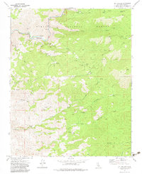
1972 Map of Mt. Adelaide
USGS Topo · Published 1983About this map
The Kern River carves through the northwestern corner of this landscape, marking a vital water corridor within the Sequoia National Forest. Near its banks, the Richbar Guard Station and recreational spots like Live Oak Picnic Area and Upper Richbar Picnic Area signify the managed use of these woods during the early 1970s. Infrastructure for water and power is evident through the presence of a Flume, a Gaging Station, and various water tanks.
Find a feature on this map
44 named features on this map. Tap any name to fly to it.
Don’t see what you’re looking for? This feature index may not catch every label — zoom into the map to look around manually.
Map Details
Editions of this 1972 Mt. Adelaide Map
4 editions found
Other maps of this area

1914 · Caliente
USGS Topo · 1:125,000

1920 · Delonagha
USGS Topo · 1:62,500

1926 · Glennville
USGS Topo · 1:62,500

1929 · Bena
USGS Topo · 1:31,680

1931 · Edison
USGS Topo · 1:31,680

1932 · Bena
USGS Topo · 1:31,680

1932 · Woody
USGS Topo · 1:62,500

1935 · Woody
USGS Topo · 1:62,500

1936 · Tobias Peak
USGS Topo · 1:125,000

1943 · Breckenridge Mountain
USGS Topo · 1:62,500