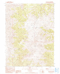
1990 Map of Mt. Augusta
USGS Topo · Published 1990About this map
The Alpine Mountains dominate this high-desert Nevada landscape, culminating at the summit of Mt Augusta. This 1990 provisional edition, based on earlier aerial photography and field checks from the late 1980s, reveals a terrain defined by steep canyons and vital water sources in an otherwise arid region. The drainage patterns are clearly visible, with Sage Hen Creek and Horse Creek cutting through the slopes, while named canyons like Florence Canyon and Starr Canyon create a complex network of ridges.
Find a feature on this map
18 named features on this map. Tap any name to fly to it.
Don’t see what you’re looking for? This feature index may not catch every label — zoom into the map to look around manually.
Map Details
Editions of this 1990 Mt. Augusta Map
This is the sole edition of this map. No revisions or reprints were ever made.
Other maps of this area

1908 · Carson Sink
USGS Topo · 1:250,000

1910 · Carson Sink
USGS Topo · 1:250,000

1955 · Millett
USGS Topo · 1:250,000

1957 · Reno
USGS Topo · 1:250,000

1959 · Reno
USGS Topo · 1:250,000

1959 · Millett
USGS Topo · 1:250,000

1960 · Reno
USGS Topo · 1:250,000

1966 · Clan Alpine Ranch
USGS Topo · 1:62,500

1969 · Camp Creek Canyon
USGS Topo · 1:24,000

1969 · Cold Springs
USGS Topo · 1:24,000