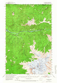
1952 Map of Mt. Baker
USGS Topo · Published 1968About this map
Mt Baker dominates this 1952 field-checked survey, showing the peak's ice-covered summit including Grant Pk, the Roman Wall, and Summit Crater. The glacial drainage systems are mapped in detail, with Thunder Glacier and others feeding the tributaries of the North Fork Nooksack River. Lower elevations reveal the industrial and logistical footprint of the era, from the Nooksack Power Plant and Excelsior Mine to the rail infrastructure of the Milwaukee Road.
Find a feature on this map
89 named features on this map. Tap any name to fly to it.
Don’t see what you’re looking for? This feature index may not catch every label — zoom into the map to look around manually.
Map Details
Editions of this 1952 Mt. Baker Map
4 editions found
Other maps of this area

1909 · Mt Baker
USGS Topo · 1:192,000

1915 · Mt. Baker
USGS Topo · 1:250,000

1919 · Van Zandt
USGS Topo · 1:62,500

1921 · Wickersham
USGS Topo · 1:62,500

1951 · Wickersham
USGS Topo · 1:62,500

1951 · Van Zandt
USGS Topo · 1:62,500

1952 · Lake Shannon
USGS Topo · 1:62,500

1952 · Mt. Baker
USGS Topo · 1:62,500

1952 · Hamilton
USGS Topo · 1:62,500

1953 · Mt Shuksan
USGS Topo · 1:62,500