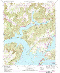
1984 Map of Mt Carmel
USGS Topo · Published 1984About this map
Guntersville Lake dominates this 1980s landscape, where the Tennessee River winds through the prominent ridges of Gunters Mountain and Bishop Mountain. The map reveals a complex shoreline of inlets and points, including Hale Point and Ft Deposit Point, that shape the local geography and recreation. In the northeast, the settlement of Noahs Ark sits near Honeycomb Spring, while the community of Henryville anchors the southeastern reach near Seibold.
Find a feature on this map
82 named features on this map. Tap any name to fly to it.
Don’t see what you’re looking for? This feature index may not catch every label — zoom into the map to look around manually.
Map Details
Editions of this 1984 Mt Carmel Map
This is the sole edition of this map. No revisions or reprints were ever made.
Other maps of this area

1885 · Gadsden
USGS Topo · 1:125,000

1888 · Gadsden
USGS Topo · 1:125,000

1888 · Scottsboro
USGS Topo · 1:125,000

1892 · Scottsboro
USGS Topo · 1:125,000

1892 · Gadsden
USGS Topo · 1:125,000

1895 · Gadsden
USGS Topo · 1:125,000

1903 · Gadsden
USGS Topo · 1:125,000

1936 · Guntersville
USGS Topo · 1:24,000

1936 · Columbus City
USGS Topo · 1:24,000

1936 · New Hope
USGS Topo · 1:24,000