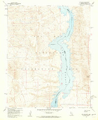
1959 Map of Mt. Davis
USGS Topo · Published 1960About this map
Lake Mohave dominates this 1950s landscape, representing a transformative era for the Colorado River basin following the completion of Davis Dam downstream. This survey documents the reservoir's reach through the Cottonwood Valley, where the water level is recorded at a maximum elevation of 647 feet. The boundary between Nevada and Arizona runs down the center of the channel, dividing Clark and Mohave counties.
Find a feature on this map
10 named features on this map. Tap any name to fly to it.
Don’t see what you’re looking for? This feature index may not catch every label — zoom into the map to look around manually.
Map Details
Editions of this 1959 Mt. Davis Map
3 editions found
Other maps of this area

1886 · Camp Mohave
USGS Topo · 1:250,000

1892 · Camp Mohave
USGS Topo · 1:250,000

1926 · Nelson
USGS Topo · 1:96,000

1926 · Mohave City
USGS Topo · 1:96,000

1942 · Camp Mohave
USGS Topo · 1:250,000

1947 · Kingman
USGS Topo · 1:250,000

1948 · Kingman
USGS Topo · 1:250,000

1954 · Kingman
USGS Topo · 1:250,000

1955 · Kingman
USGS Topo · 1:250,000

1958 · Kingman
USGS Topo · 1:250,000