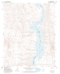
1959 Map of Mt. Davis
USGS Topo · Published 1993About this map
Lake Mohave and the Colorado River dominate this desert landscape at the border of Nevada and Arizona. The map illustrates the area as it appeared in the late 1950s, shortly after the impoundment of the river within the Lake Mead National Recreation Area. High desert terrain is marked by prominent peaks such as Opal Mountain to the west and Mt Davis VABM 2034 to the east, overlooking the wide Cottonwood Valley. This survey captures the transition of the river into a controlled reservoir system, showing the approximate state and county boundaries between Clark County, Nevada, and Mohave County, Arizona, as they follow the original river channel. Beyond the water, the land is largely defined by topographic elevation and sparse 4wd tracks, reflecting the isolation of this reach of the Colorado before modern development.
Find a feature on this map
10 named features on this map. Tap any name to fly to it.
Don’t see what you’re looking for? This feature index may not catch every label — zoom into the map to look around manually.
Map Details
Editions of this 1959 Mt. Davis Map
3 editions found
Other maps of this area

1886 · Camp Mohave
USGS Topo · 1:250,000

1892 · Camp Mohave
USGS Topo · 1:250,000

1926 · Nelson
USGS Topo · 1:96,000

1926 · Mohave City
USGS Topo · 1:96,000

1942 · Camp Mohave
USGS Topo · 1:250,000

1947 · Kingman
USGS Topo · 1:250,000

1948 · Kingman
USGS Topo · 1:250,000

1954 · Kingman
USGS Topo · 1:250,000

1955 · Kingman
USGS Topo · 1:250,000

1958 · Kingman
USGS Topo · 1:250,000