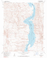
1959 Map of Mt. Davis
USGS Topo · Published 1990About this map
Colorado River waters fill the canyon floor in this mid-century survey, forming the expansive Lake Mohave within the Lake Mead National Recreation Area. The landscape is defined by sharp elevation changes, anchored by the prominent Mt Davis on the eastern side of the river and the Opal Mountain range to the west. This mapping reflects the era after Davis Dam created the reservoir, showing a fixed maximum elevation of 647 feet.
Find a feature on this map
15 named features on this map. Tap any name to fly to it.
Don’t see what you’re looking for? This feature index may not catch every label — zoom into the map to look around manually.
Map Details
Editions of this 1959 Mt. Davis Map
3 editions found
Other maps of this area

1886 · Camp Mohave
USGS Topo · 1:250,000

1892 · Camp Mohave
USGS Topo · 1:250,000

1926 · Nelson
USGS Topo · 1:96,000

1926 · Mohave City
USGS Topo · 1:96,000

1942 · Camp Mohave
USGS Topo · 1:250,000

1947 · Kingman
USGS Topo · 1:250,000

1948 · Kingman
USGS Topo · 1:250,000

1954 · Kingman
USGS Topo · 1:250,000

1955 · Kingman
USGS Topo · 1:250,000

1958 · Kingman
USGS Topo · 1:250,000