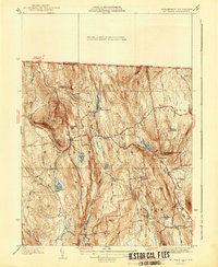
1941 Map of Mt Grace
USGS Topo · Published 1941About this map
Mt Grace dominates the western landscape of this 1941 survey, crowned by a Fire Tower that serves as a sentinel over the surrounding uplands of Franklin and Worcester Counties. The village of Warwick sits at a central crossroads, connecting historical routes like the Northfield Road and Athol Road. To the east, the terrain descends into the drainage of the Tully River and Tully Brook, where small water bodies such as Richards Mill Pond and Sheomet Lake suggest a long history of water-powered industry and local recreation.
Find a feature on this map
63 named features on this map. Tap any name to fly to it.
Don’t see what you’re looking for? This feature index may not catch every label — zoom into the map to look around manually.
Map Details
Editions of this 1941 Mt Grace Map
2 editions found
Other maps of this area

1887 · Warwick
USGS Topo · 1:62,500

1887 · Winchendon
USGS Topo · 1:62,500

1889 · Warwick
USGS Topo · 1:62,500

1890 · Winchendon
USGS Topo · 1:62,500

1894 · Winchendon
USGS Topo · 1:62,500

1894 · Warwick
USGS Topo · 1:62,500

1898 · Monadnock
USGS Topo · 1:62,500

1898 · Keene
USGS Topo · 1:62,500

1932 · Warwick
USGS Topo · 1:48,000

1932 · Winchendon
USGS Topo · 1:48,000