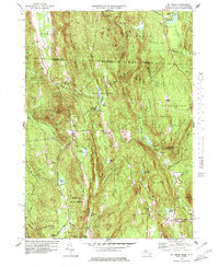
1977 Map of Mt Grace
USGS Topo · Published 1979About this map
Warwick State Forest and Mt Grace State Forest dominate the interior of this Massachusetts-New Hampshire borderland, creating a heavily wooded landscape punctuated by small village centers and historic school sites. The town of Warwick serves as a central hub, while smaller clusters like Blissville and Baptist Corners indicate the older patterns of rural settlement. Higher elevations such as Mt Grace and Wheeler Mtn overlook a complex network of wetlands and small water bodies, including Richards Mill Pond and Shemet Lake. Local education and community history are marked by the presence of the Center Sch and the Gale-Brooks Sch, while several family and town cemeteries like Gale-Gates Cem and Newton Cem are preserved within the forest boundaries. The terrain's character is defined by narrow valleys like Sunny Valley and numerous brooks that feed into the Tully River drainage system.
Find a feature on this map
84 named features on this map. Tap any name to fly to it.
Don’t see what you’re looking for? This feature index may not catch every label — zoom into the map to look around manually.
Map Details
Editions of this 1977 Mt Grace Map
3 editions found
Other maps of this area

1887 · Warwick
USGS Topo · 1:62,500

1887 · Winchendon
USGS Topo · 1:62,500

1889 · Warwick
USGS Topo · 1:62,500

1890 · Winchendon
USGS Topo · 1:62,500

1894 · Winchendon
USGS Topo · 1:62,500

1894 · Warwick
USGS Topo · 1:62,500

1898 · Monadnock
USGS Topo · 1:62,500

1898 · Keene
USGS Topo · 1:62,500

1932 · Warwick
USGS Topo · 1:48,000

1932 · Winchendon
USGS Topo · 1:48,000