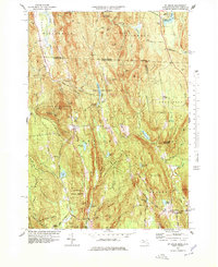
1977 Map of Mt Grace
USGS Topo · Published 1979About this map
Warwick and Royalston form the heart of this landscape, where the terrain is dominated by the steep rises of Mt Grace and Little Mt Grace. The 1970s environment shown here is one of dense state forests and scattered rural settlements, tied together by a network of historic routes like Old Winchester Road and Old Royalston Road. Local life centers around small clusters such as Mayo Corners and North Orange, with the presence of Center Sch and Gale-Brooks Sch marking the community hubs of the era.
Find a feature on this map
79 named features on this map. Tap any name to fly to it.
Don’t see what you’re looking for? This feature index may not catch every label — zoom into the map to look around manually.
Map Details
Editions of this 1977 Mt Grace Map
3 editions found
Other maps of this area

1887 · Warwick
USGS Topo · 1:62,500

1887 · Winchendon
USGS Topo · 1:62,500

1889 · Warwick
USGS Topo · 1:62,500

1890 · Winchendon
USGS Topo · 1:62,500

1894 · Winchendon
USGS Topo · 1:62,500

1894 · Warwick
USGS Topo · 1:62,500

1898 · Monadnock
USGS Topo · 1:62,500

1898 · Keene
USGS Topo · 1:62,500

1932 · Warwick
USGS Topo · 1:48,000

1932 · Winchendon
USGS Topo · 1:48,000