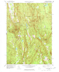
1977 Map of Mt Grace
USGS Topo · Published 1977About this map
Warwick stands as the central hub of this late-20th-century landscape, surrounded by the heavily forested slopes of Warwick State Forest and Mt Grace State Forest. The village maintains its historical footprint with the Center Sch and a series of burial grounds including South Cem and Newton Cem. The terrain is defined by a succession of high points like Mt Grace, which features a Lookout Tower, and Tully Mtn rising above the Tully River valley.
Find a feature on this map
95 named features on this map. Tap any name to fly to it.
Don’t see what you’re looking for? This feature index may not catch every label — zoom into the map to look around manually.
Map Details
Editions of this 1977 Mt Grace Map
3 editions found
Other maps of this area

1887 · Warwick
USGS Topo · 1:62,500

1887 · Winchendon
USGS Topo · 1:62,500

1889 · Warwick
USGS Topo · 1:62,500

1890 · Winchendon
USGS Topo · 1:62,500

1894 · Winchendon
USGS Topo · 1:62,500

1894 · Warwick
USGS Topo · 1:62,500

1898 · Monadnock
USGS Topo · 1:62,500

1898 · Keene
USGS Topo · 1:62,500

1932 · Warwick
USGS Topo · 1:48,000

1932 · Winchendon
USGS Topo · 1:48,000