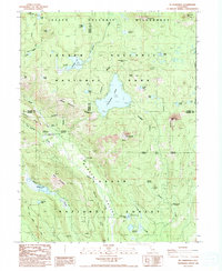
1985 Map of Mt. Harkness
USGS Topo · Published 1985About this map
Juniper Lake sits at the heart of this high-altitude landscape, where the volcanic geology of the southern Cascades is meticulously documented. The terrain is defined by dramatic elevations, from the Crystal Cliffs to the summit of Mt Harkness. This 1985 provisional survey captures the intersection of three major protected areas: Lassen Volcanic National Park, Lassen Volcanic Wilderness, and Lassen National Forest. Evidence of human activity is clustered around seasonal outposts like Kelly Camp and Lee Camp, alongside the Fleischmann Boy Scout Camp near the Warner Valley. The Pacific Crest National Scenic Trail winds through the western portion of the map, tracing a path through the transition between Flatiron Ridge and the meadows surrounding Willow Lake.
Find a feature on this map
43 named features on this map. Tap any name to fly to it.
Don’t see what you’re looking for? This feature index may not catch every label — zoom into the map to look around manually.
Map Details
Editions of this 1985 Mt. Harkness Map
This is the sole edition of this map. No revisions or reprints were ever made.
Other maps of this area

1886 · Lassen Peak
USGS Topo · 1:250,000

1892 · Lassen Peak
USGS Topo · 1:250,000

1894 · Lassen Peak
USGS Topo · 1:250,000

1939 · Halls Flat
USGS Topo · 1:125,000

1955 · Westwood
USGS Topo · 1:250,000

1956 · Mt. Harkness
USGS Topo · 1:62,500

1956 · Chester
USGS Topo · 1:62,500

1956 · Harvey Mtn
USGS Topo · 1:62,500

1957 · Prospect Peak
USGS Topo · 1:62,500

1958 · Westwood
USGS Topo · 1:250,000