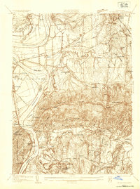
1935 Map of Mt Holyoke
USGS Topo · Published 1935About this map
The Holyoke Range dominates the southern landscape of this 1930s survey, anchoring a region defined by its prominent academic institutions and the winding Connecticut River. Higher education is central to the area's layout, with the campuses of Amherst College and Mt Holyoke College clearly delineated alongside local educational landmarks like the Harts Brook Sch. The river valley shows a complex hydrology, featuring the distinctive Ox Bow, Elwell Island, and the drainage of Bachelor Brook. Small rural settlements such as Pearl City, Hockanum, and Moody Corner are connected by a network of local roads and the prominent Boston and Maine Railroad. This map captures a transition point in Connecticut River Valley history, where traditional agricultural settlements and early aviation at the Landing Field sit alongside established collegiate centers and expanding industrial infrastructure like the cross-country Transmission Line.
Find a feature on this map
67 named features on this map. Tap any name to fly to it.
Don’t see what you’re looking for? This feature index may not catch every label — zoom into the map to look around manually.
Map Details
Editions of this 1935 Mt Holyoke Map
This is the sole edition of this map. No revisions or reprints were ever made.
Other maps of this area

1885 · Northampton
USGS Topo · 1:62,500

1886 · Springfield
USGS Topo · 1:62,500

1886 · Northampton
USGS Topo · 1:62,500

1887 · Palmer
USGS Topo · 1:62,500

1887 · Belchertown
USGS Topo · 1:62,500

1889 · Springfield
USGS Topo · 1:62,500

1889 · Palmer
USGS Topo · 1:62,500

1890 · Belchertown
USGS Topo · 1:62,500

1891 · Northampton
USGS Topo · 1:62,500

1893 · Northampton
USGS Topo · 1:62,500