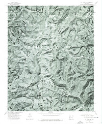
1974 Map of Mt Judea SW
USGS Topo · Published 1975About this map
Deer and Cowell serve as the primary focal points in this 1974 orthophotograph, which provides a high-altitude visual record of the Newton County highlands. Unlike traditional topographic maps that use contour lines to represent elevation, this imagery utilizes processed aerial photography to show the actual texture of the land, including the dense forest cover and the cleared parcels of land along the ridges where these small settlements are located. The visual data highlights how the road network follows the winding natural topography, connecting isolated homesites and small agricultural clearings to the central thoroughfares at Deer and Cowell. This specific photographic perspective is especially useful for researchers looking to identify exact building locations and land use patterns that standard line-drawn maps might simplify or omit.
Find a feature on this map
2 named features on this map. Tap any name to fly to it.
Don’t see what you’re looking for? This feature index may not catch every label — zoom into the map to look around manually.
Map Details
Editions of this 1974 Mt Judea SW Map
This is the sole edition of this map. No revisions or reprints were ever made.
Other maps of this area

1889 · Treat
USGS Topo · 1:62,500

1889 · Ozone
USGS Topo · 1:62,500

1932 · Treat
USGS Topo · 1:62,500

1933 · Mt Judea
USGS Topo · 1:62,500

1934 · Treat
USGS Topo · 1:62,500

1934 · Ozone
USGS Topo · 1:62,500

1936 · Ozone
USGS Topo · 1:62,500

1940 · Mt Judea
USGS Topo · 1:62,500

1956 · Russellville
USGS Topo · 1:250,000

1964 · Russellville
USGS Topo · 1:250,000