
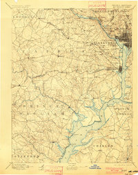
1897 Map of Mt. Vernon
USGS Topo · Published 1897About this map
The Potomac River corridor serves as the central artery for this late 19th-century survey, dividing the growing federal district from the rural expanses of northern Virginia and Maryland. The landscape is defined by the strategic defense of the capital, marked by Fort Myer and Fort Washington, alongside significant civic landmarks like Arlington National Cemetery. In Alexandria, the transition from an early maritime economy to a rail-centered one is evident, with the B. & O. R. R. and the Va. Midland Div. stitching together small settlements and junctions. Further inland, the map captures the dispersed nature of Fairfax County before suburban expansion, highlighting long-standing crossroad communities such as Tyson Cross Roads and Annandale. The reliance on river crossings is noted by the prominent Chain Bridge and Aqueduct Bridge, which remained critical links between the rural hinterlands and the urban center.
Find a feature on this map
147 named features on this map. Tap any name to fly to it.
Don’t see what you’re looking for? This feature index may not catch every label — zoom into the map to look around manually.
Map Details
Editions of this 1897 Mt. Vernon Map
2 editions found
Other maps of this area

1884 · Harpers Ferry
USGS Topo · 1:125,000

1887 · Spottsylvania
USGS Topo · 1:125,000

1889 · Fredericksburg
USGS Topo · 1:125,000

1890 · Mt. Vernon
USGS Topo · 1:125,000

1891 · Harpers Ferry
USGS Topo · 1:125,000

1891 · Mt. Vernon
USGS Topo · 1:125,000

1892 · Laurel
USGS Topo · 1:62,500

1892 · Fredericksburg
USGS Topo · 1:125,000

1892 · Spottsylvania
USGS Topo · 1:125,000

1892 · Brandywine
USGS Topo · 1:62,500