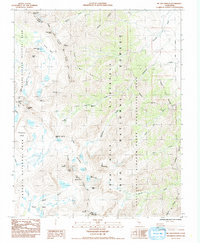
1984 Map of Mt. Williamson
USGS Topo · Published 1985About this map
High peaks of the Sierra Nevada define the landscape where Kings Canyon National Park, Sequoia National Park, and Inyo National Forest converge. This 1984 survey documents a formidable alpine environment dominated by massifs like Mt Williamson and Mt Tyndall, along with the high-altitude Wright Lakes basin. The map captures the complex drainage patterns of Williamson Creek and Shepherd Creek before they descend toward the Owens Valley.
Find a feature on this map
46 named features on this map. Tap any name to fly to it.
Don’t see what you’re looking for? This feature index may not catch every label — zoom into the map to look around manually.
Map Details
Editions of this 1984 Mt. Williamson Map
This is the sole edition of this map. No revisions or reprints were ever made.
Other maps of this area

1907 · Mt. Whitney
USGS Topo · 1:125,000

1919 · Mt. Whitney
USGS Topo · 1:125,000

1937 · Mt. Whitney
USGS Topo · 1:125,000

1948 · Fresno
USGS Topo · 1:250,000

1951 · Independence
USGS Topo · 1:62,500

1953 · Mt. Pinchot
USGS Topo · 1:62,500

1955 · Fresno
USGS Topo · 1:250,000

1956 · Fresno
USGS Topo · 1:250,000

1956 · Mount Whitney
USGS Topo · 1:62,500

1958 · Fresno
USGS Topo · 1:250,000