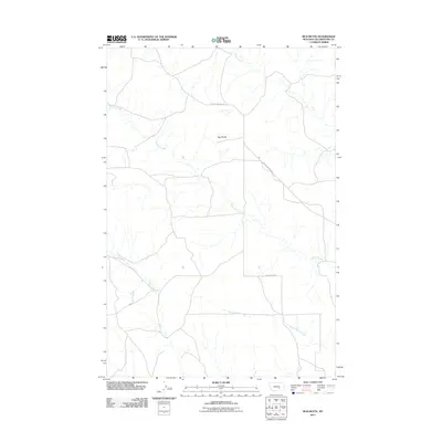
2011 Map of Mud Butte
USGS Topo · Published 2011About this map
Mud Butte stands as a central topographical landmark in this portion of Yellowstone County, overlooking a network of ephemeral watercourses and prairie roads. This early 21st-century landscape is defined by the winding paths of Antelope Creek and its tributary, Dry Antelope Creek, which drain the open range alongside Buffalo Creek and Mill Creek. The map documents the rural infrastructure of the era, centered on the transit corridors of Custer Pineview Rd and McWhorter Rd. The sparse distribution of named features reflects the expansive, undeveloped character of the Montana plains, where water sources and prominent high points like the butte served as the primary orienting markers for local residents and travelers.
Find a feature on this map
7 named features on this map. Tap any name to fly to it.
Don’t see what you’re looking for? This feature index may not catch every label — zoom into the map to look around manually.
Map Details
Editions of this 2011 Mud Butte Map
This is the sole edition of this map. No revisions or reprints were ever made.
Other maps of this area

1954 · Forsyth
USGS Topo · 1:250,000

1957 · Forsyth
USGS Topo · 1:250,000

1958 · Forsyth
USGS Topo · 1:250,000

1960 · Coal Bank Creek
USGS Topo · 1:24,000

1960 · Waco
USGS Topo · 1:24,000
1967 · Big Marys Island
USGS Topo · 1:24,000
1967 · Bull Mountain
USGS Topo · 1:24,000

1979 · Hysham
USGS Topo · 1:100,000

1980 · Mud Butte
USGS Topo · 1:24,000
1980 · Bull Mountain NW
USGS Topo · 1:24,000