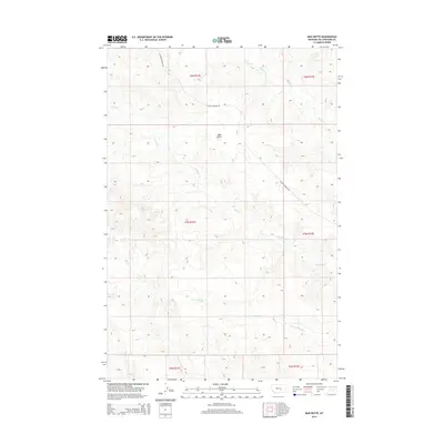
2014 Map of Mud Butte
USGS Topo · Published 2014About this map
Mud Butte rises as a central landmark in this portion of Yellowstone County, overlooking a landscape defined by its seasonal drainages and early 21st-century rural road networks. The terrain is marked by the winding courses of Antelope Cr and Buffalo Cr, which cut through the northern townships, while Dry Antelope Cr and Mill Cr characterize the southern drainage patterns. This survey reflects the enduring cattle-country land divisions of the Public Land Survey System, including t5n r31e and surrounding townships. Custer Pineview Rd provides the primary transit corridor through the western sections of this high plains environment, illustrating the sparse but vital infrastructure connecting these remote Montana ranges.
Find a feature on this map
12 named features on this map. Tap any name to fly to it.
Don’t see what you’re looking for? This feature index may not catch every label — zoom into the map to look around manually.
Map Details
Editions of this 2014 Mud Butte Map
This is the sole edition of this map. No revisions or reprints were ever made.
Other maps of this area

1954 · Forsyth
USGS Topo · 1:250,000

1957 · Forsyth
USGS Topo · 1:250,000

1958 · Forsyth
USGS Topo · 1:250,000

1960 · Coal Bank Creek
USGS Topo · 1:24,000

1960 · Waco
USGS Topo · 1:24,000
1967 · Big Marys Island
USGS Topo · 1:24,000
1967 · Bull Mountain
USGS Topo · 1:24,000

1979 · Hysham
USGS Topo · 1:100,000

1980 · Mud Butte
USGS Topo · 1:24,000
1980 · Bull Mountain NW
USGS Topo · 1:24,000