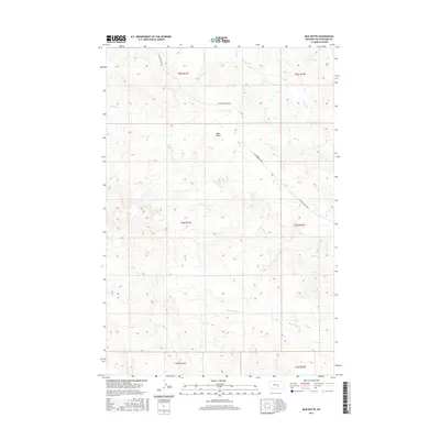
2017 Map of Mud Butte
USGS Topo · Published 2017About this map
Mud Butte rises as a central landmark within this expansive Yellowstone County landscape, where the geography is defined by a network of drainage systems. The terrain is marked by the seasonal flow of Antelope Cr and its tributary, Dry Antelope Cr, alongside Mill Cr and Buffalo Cr. These waterways carve a distinct pattern across the high plains, illustrating the drainage basin's role in local ranching and land use. Human passage through this section of Montana is primarily anchored by Custer Pineview Rd, which winds across the northern and eastern portions of the map. This topographic study reveals a largely undeveloped area where legal land divisions like t6n r31e and t5n r32e organize the territory into a grid of sections, a system essential for land ownership and resource management in the western United States.
Find a feature on this map
12 named features on this map. Tap any name to fly to it.
Don’t see what you’re looking for? This feature index may not catch every label — zoom into the map to look around manually.
Map Details
Editions of this 2017 Mud Butte Map
This is the sole edition of this map. No revisions or reprints were ever made.
Other maps of this area

1954 · Forsyth
USGS Topo · 1:250,000

1957 · Forsyth
USGS Topo · 1:250,000

1958 · Forsyth
USGS Topo · 1:250,000

1960 · Coal Bank Creek
USGS Topo · 1:24,000

1960 · Waco
USGS Topo · 1:24,000
1967 · Big Marys Island
USGS Topo · 1:24,000
1967 · Bull Mountain
USGS Topo · 1:24,000

1979 · Hysham
USGS Topo · 1:100,000

1980 · Mud Butte
USGS Topo · 1:24,000
1980 · Bull Mountain NW
USGS Topo · 1:24,000