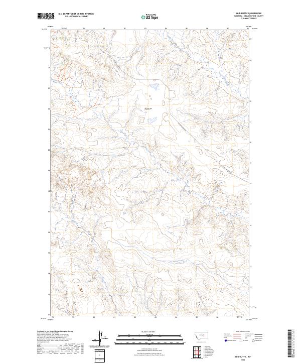
2024 Map of Mud Butte
USGS Topo · Published 2024About this map
Mud Butte stands as a prominent landmark in this segment of Yellowstone County, overlooking a landscape defined by the drainage systems of Antelope Creek and its southern counterpart, Dry Antelope Creek. The topographic layout reveals a high-plains environment where water sources like Buffalo Creek and Mill Creek have carved distinct drainage patterns through the terrain. Human presence is primarily represented by the winding path of Custer Pineview Rd, which serves as the primary artery through these sections. This survey provides an exact look at the rural land divisions and township boundaries, such as t5n r31e and t6n r32e, essential for researchers tracing contemporary land use or family property boundaries in this open-range region of Montana.
Find a feature on this map
12 named features on this map. Tap any name to fly to it.
Don’t see what you’re looking for? This feature index may not catch every label — zoom into the map to look around manually.
Map Details
Editions of this 2024 Mud Butte Map
This is the sole edition of this map. No revisions or reprints were ever made.
Other maps of this area

1954 · Forsyth
USGS Topo · 1:250,000

1957 · Forsyth
USGS Topo · 1:250,000

1958 · Forsyth
USGS Topo · 1:250,000

1960 · Coal Bank Creek
USGS Topo · 1:24,000

1960 · Waco
USGS Topo · 1:24,000
1967 · Big Marys Island
USGS Topo · 1:24,000
1967 · Bull Mountain
USGS Topo · 1:24,000

1979 · Hysham
USGS Topo · 1:100,000

1980 · Mud Butte
USGS Topo · 1:24,000
1980 · Bull Mountain NW
USGS Topo · 1:24,000