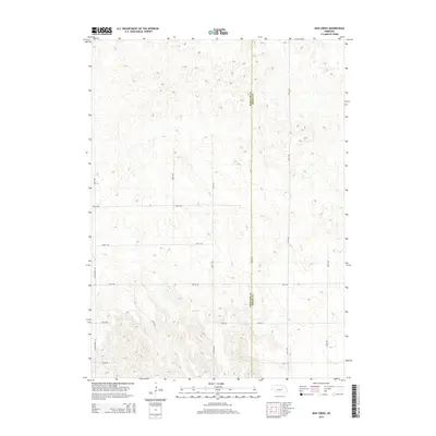
2014 Map of Mud Creek
USGS Topo · Published 2014About this map
The rolling hills of the Nebraska sandhills region are defined by the winding course of Mud Cr in this rural survey of the borderlands between Wheeler and Boone counties. The landscape is characterized by a high-density network of section roads and cattle trails, centered around the Mignery Ranch. This ranching infrastructure is linked by a series of graded routes such as 827th Rd and 509th Ave, which provide access to the remote pastures. The presence of Old Highway 101 on the western edge of the quadrangle marks an earlier era of regional travel, following the section lines across a terrain sculpted by wind and drainage into a complex series of ridges and depressions. The map illustrates the persistence of large-scale landholdings and the systematic grid of the Great Plains late into the modern era.
Find a feature on this map
18 named features on this map. Tap any name to fly to it.
Don’t see what you’re looking for? This feature index may not catch every label — zoom into the map to look around manually.
Map Details
Editions of this 2014 Mud Creek Map
This is the sole edition of this map. No revisions or reprints were ever made.
Other maps of this area

1954 · Spalding
USGS Topo · 1:24,000

1954 · Akron
USGS Topo · 1:24,000

1954 · Spalding NW
USGS Topo · 1:24,000

1955 · Broken Bow
USGS Topo · 1:250,000

1956 · Broken Bow
USGS Topo · 1:250,000

1960 · Spalding 2 SW
USGS Topo · 1:24,000

1960 · Spalding 2 NW
USGS Topo · 1:24,000

1960 · Spalding 2 NE
USGS Topo · 1:24,000

1960 · Spalding 2 SE
USGS Topo · 1:24,000

1963 · Elgin NW
USGS Topo · 1:24,000