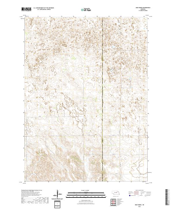
2021 Map of Mud Creek
USGS Topo · Published 2021About this map
Wheeler County and Boone County meet in this Nebraska sandhills landscape, where the shifting elevations of the High Plains are etched across the surface in a dense network of contours. The eponymous Mud Creek flows through the southwestern portion of the map, serving as the primary drainage for this transition between counties. The area is defined by a strictly rectilinear grid of section lines and local thoroughfares, including the distinct path of Old Hwy 101 and a series of numbered rural routes like 825 Rd and 200th St. This 2021 topographic record reveals a high-plains geography where natural watercourses and man-made county boundaries intersect, providing a clear view of the modern land divisions and access roads that structure these remote ranching and agricultural lands.
Find a feature on this map
19 named features on this map. Tap any name to fly to it.
Don’t see what you’re looking for? This feature index may not catch every label — zoom into the map to look around manually.
Map Details
Editions of this 2021 Mud Creek Map
This is the sole edition of this map. No revisions or reprints were ever made.
Other maps of this area

1954 · Spalding
USGS Topo · 1:24,000

1954 · Akron
USGS Topo · 1:24,000

1954 · Spalding NW
USGS Topo · 1:24,000

1955 · Broken Bow
USGS Topo · 1:250,000

1956 · Broken Bow
USGS Topo · 1:250,000

1960 · Spalding 2 SW
USGS Topo · 1:24,000

1960 · Spalding 2 NW
USGS Topo · 1:24,000

1960 · Spalding 2 NE
USGS Topo · 1:24,000

1960 · Spalding 2 SE
USGS Topo · 1:24,000

1963 · Elgin NW
USGS Topo · 1:24,000