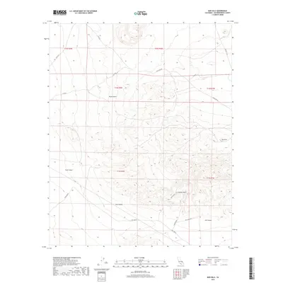
2018 Map of Mud Hills
USGS Topo · Published 2018About this map
Rainbow Basin serves as a central geological landmark in this arid section of San Bernardino County. The landscape is defined by deep drainage systems and rugged formations, notably Fossil Canyon and Coon Canyon in the southwest, and the eponymous Mud Hills to the east. This survey from the late 2010s shows a territory largely managed by the Bureau of Land Management, where the natural topography dictates the few access points. Human activity is evidenced primarily by unpaved corridors such as Fossil Bed Rd and Owl Canyon Rd, which lead into the heart of the Mojave Desert. This environment is a significant site for paleontological study, indicated by the specific naming of canyon and road features. The intricate contour lines across Owl Canyon reflect the erosional forces that have shaped these badlands over millennia.
Find a feature on this map
19 named features on this map. Tap any name to fly to it.
Don’t see what you’re looking for? This feature index may not catch every label — zoom into the map to look around manually.
Map Details
Editions of this 2018 Mud Hills Map
This is the sole edition of this map. No revisions or reprints were ever made.
Other maps of this area

1915 · Searles Lake
USGS Topo · 1:250,000

1932 · Barstow
USGS Topo · 1:125,000

1933 · Avawatz Mountains
USGS Topo · 1:250,000

1934 · Barstow
USGS Topo · 1:125,000

1947 · Trona
USGS Topo · 1:250,000

1948 · Trona
USGS Topo · 1:250,000

1948 · Lane Mountain
USGS Topo · 1:62,500

1951 · Lane Mountain
USGS Topo · 1:62,500

1953 · San Bernardino
USGS Topo · 1:250,000

1953 · Trona
USGS Topo · 1:250,000