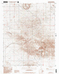
1996 Map of Mud Hills
USGS Topo · Published 1999About this map
Coolgardie Camp anchors the northern reaches of this High Desert landscape, where the terrain is defined by the sharp ridges of the Mud Hills and the Waterman Hills. This 1996 survey illustrates a region shaped by both geological interest and extractive industry, featuring several Prospect sites, a Quarry, and a Mine scattered among the drainages. Significant natural landmarks like Rainbow Basin and Fossil Canyon indicate the area's rich paleontological and geological value. Navigating the arid landscape is restricted to rugged corridors like One Way roads and various 4wd tracks that thread through Coon Canyon and toward the Owl Canyon Campground. The numerous vertical control stations, marked as VFGC points, suggest the intensive topographic and scientific mapping efforts undertaken to document this complex desert topography.
Find a feature on this map
34 named features on this map. Tap any name to fly to it.
Don’t see what you’re looking for? This feature index may not catch every label — zoom into the map to look around manually.
Map Details
Editions of this 1996 Mud Hills Map
This is the sole edition of this map. No revisions or reprints were ever made.
Other maps of this area

1915 · Searles Lake
USGS Topo · 1:250,000

1932 · Barstow
USGS Topo · 1:125,000

1933 · Avawatz Mountains
USGS Topo · 1:250,000

1934 · Barstow
USGS Topo · 1:125,000

1947 · Trona
USGS Topo · 1:250,000

1948 · Trona
USGS Topo · 1:250,000

1948 · Lane Mountain
USGS Topo · 1:62,500

1951 · Lane Mountain
USGS Topo · 1:62,500

1953 · San Bernardino
USGS Topo · 1:250,000

1953 · Trona
USGS Topo · 1:250,000