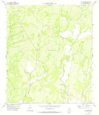
1978 Map of Mud Springs
USGS Topo · Published 1978About this map
Mud Springs serves as a central landmark in this southwestern Texas landscape, where the seasonal hydrology of Perdido Creek and West Pinto Creek defines the terrain. The area is characterized by an extensive network of ephemeral waterways, including the East Fork Sycamore Creek and Little Perdido Creek, which carve through the arid scrubland. In the late 1970s, human activity in this corner of Kinney County was marked by resource extraction and utility maintenance, evidenced by several Gravel Pits and numerous scattered wells. A primitive Landing Strip located in the southern portion of the quadrangle suggests the necessity of aerial access for ranching or surveying operations in this isolated environment. The namesake Mud Spring remains a notable point of interest for those tracing the historical water sources that once supported local livestock and early travelers.
Find a feature on this map
11 named features on this map. Tap any name to fly to it.
Don’t see what you’re looking for? This feature index may not catch every label — zoom into the map to look around manually.
Map Details
Editions of this 1978 Mud Springs Map
This is the sole edition of this map. No revisions or reprints were ever made.
Other maps of this area

1893 · Nueces
USGS Topo · 1:125,000

1896 · Nueces
USGS Topo · 1:125,000

1896 · Brackett
USGS Topo · 1:125,000

1897 · Brackett
USGS Topo · 1:125,000

1941 · Standart
USGS Topo · 1:62,500

1943 · Standart
USGS Topo · 1:62,500

1944 · Flat Rock
USGS Topo · 1:62,500

1944 · Brackettville
USGS Topo · 1:62,500

1944 · Indian Mountain
USGS Topo · 1:62,500

1958 · Del Rio
USGS Topo · 1:250,000