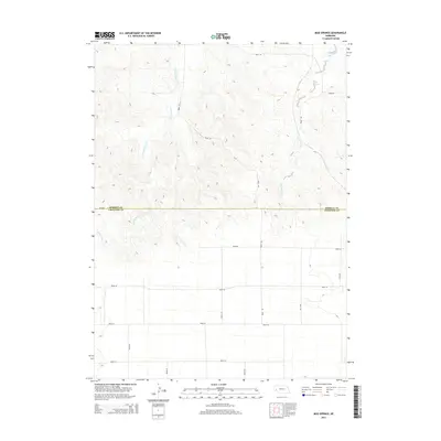
2014 Map of Mud Springs
USGS Topo · Published 2014About this map
Mud Springs stands as a focal point in this high-plains landscape where Cheyenne and Morrill counties meet. This 2014 survey captures a terrain defined by intermittent drainage systems and the sparse, grid-like infrastructure of the Nebraska panhandle. The area is marked by the winding paths of Greenwood Creek and Deep Holes Cr, which carve through the elevations of the high prairie. The map provides a clear look at the intersection of local transportation and natural hydrology, illustrating how modern section-line roads such as Road 101 and Road 58 navigate around the natural depressions and spring-fed features that have historically been vital in this arid region.
Find a feature on this map
19 named features on this map. Tap any name to fly to it.
Don’t see what you’re looking for? This feature index may not catch every label — zoom into the map to look around manually.
Map Details
Editions of this 2014 Mud Springs Map
This is the sole edition of this map. No revisions or reprints were ever made.
Other maps of this area

1896 · Browns Creek
USGS Topo · 1:125,000

1898 · Camp Clarke
USGS Topo · 1:125,000

1899 · Browns Creek
USGS Topo · 1:125,000

1899 · Sidney
USGS Topo · 1:125,000

1954 · Scottsbluff
USGS Topo · 1:250,000

1958 · Scottsbluff
USGS Topo · 1:250,000

1965 · Courthouse Rock
USGS Topo · 1:24,000

1965 · Broadwater SW
USGS Topo · 1:24,000

1972 · Gurley
USGS Topo · 1:24,000

1972 · Mud Springs SW
USGS Topo · 1:24,000