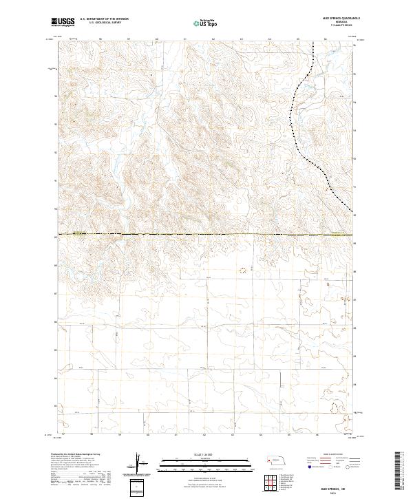
2021 Map of Mud Springs
USGS Topo · Published 2021About this map
Mud Springs anchors the north-central portion of this high plains landscape, situated within a topography defined by complex drainages and the meeting of two Nebraska counties. The transition from Morrill County and Cheyenne County is marked by a grid of rural section roads, including Rd 101 and Rd 60, which navigate the various seasonal watercourses. The drainage patterns of Greenwood Creek and the southern reaches of Deep Holes Creek carve through the terrain, illustrating the importance of water sources in this dry agricultural and ranching region. This 2021 update from the U.S. Geological Survey provides a clear view of the modern road network superimposed over the traditional Public Land Survey System township and range lines.
Find a feature on this map
23 named features on this map. Tap any name to fly to it.
Don’t see what you’re looking for? This feature index may not catch every label — zoom into the map to look around manually.
Map Details
Editions of this 2021 Mud Springs Map
This is the sole edition of this map. No revisions or reprints were ever made.
Other maps of this area

1896 · Browns Creek
USGS Topo · 1:125,000

1898 · Camp Clarke
USGS Topo · 1:125,000

1899 · Browns Creek
USGS Topo · 1:125,000

1899 · Sidney
USGS Topo · 1:125,000

1954 · Scottsbluff
USGS Topo · 1:250,000

1958 · Scottsbluff
USGS Topo · 1:250,000

1965 · Courthouse Rock
USGS Topo · 1:24,000

1965 · Broadwater SW
USGS Topo · 1:24,000

1972 · Gurley
USGS Topo · 1:24,000

1972 · Mud Springs SW
USGS Topo · 1:24,000