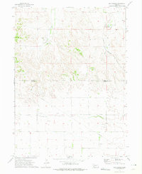
1972 Map of Mud Springs
USGS Topo · Published 1975About this map
Mud Springs and its namesake Mud Springs Sch mark the northern reaches of this High Plains landscape where the Morrill Co Cheyenne Co line divides the terrain. The map documents an evolving resource economy in the early 1970s, defined by a network of Pipeline corridors and several Oil Wells scattered across the southern Oil Field. Transportation is anchored by the Burlington Northern railroad, which follows the natural drainage of Deep Holes Creek through the eastern portion of the quadrangle. Significant water sources like Greenwood Creek provide relief to the upland topography, which is also characterized by scattered industrial sites such as a Gravel Pit and a prominent Radio Tower. The survey reflects a sparsely populated ranching and energy-producing region during a period of active petroleum development.
Find a feature on this map
13 named features on this map. Tap any name to fly to it.
Don’t see what you’re looking for? This feature index may not catch every label — zoom into the map to look around manually.
Map Details
Editions of this 1972 Mud Springs Map
This is the sole edition of this map. No revisions or reprints were ever made.
Other maps of this area

1896 · Browns Creek
USGS Topo · 1:125,000

1898 · Camp Clarke
USGS Topo · 1:125,000

1899 · Browns Creek
USGS Topo · 1:125,000

1899 · Sidney
USGS Topo · 1:125,000

1954 · Scottsbluff
USGS Topo · 1:250,000

1958 · Scottsbluff
USGS Topo · 1:250,000

1965 · Courthouse Rock
USGS Topo · 1:24,000

1965 · Broadwater SW
USGS Topo · 1:24,000

1972 · Gurley
USGS Topo · 1:24,000

1972 · Mud Springs SW
USGS Topo · 1:24,000