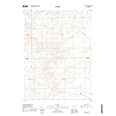
2017 Map of Mud Springs
USGS Topo · Published 2017About this map
Bates Hole defines the southwestern portion of this landscape, where the high plains of the Natrona and Carbon County line meet. This high-elevation terrain is marked by a network of ranching infrastructure and seasonal water sources. Travel through the area is guided by historic thoroughfares like the Old Casper Medicine Bow Hwy and the Bates Hole Stock Trl, reflecting the region's long-standing connection to livestock movement. Natural features like Mud Springs and Antelope Springs provide vital water points in an arid environment, while numerous small catchments such as the Chalk Hill Reservoirs and the Cronberg Pit Reservoir Number 1 indicate managed water resources for grazing. The topographical relief is punctuated by the prominent Moss Agate Ridge, which overlooks the drainage of Lone Tree Cr and Spring Cr.
Find a feature on this map
20 named features on this map. Tap any name to fly to it.
Don’t see what you’re looking for? This feature index may not catch every label — zoom into the map to look around manually.
Map Details
Editions of this 2017 Mud Springs Map
This is the sole edition of this map. No revisions or reprints were ever made.
Other maps of this area

1955 · Casper
USGS Topo · 1:250,000

1958 · Casper
USGS Topo · 1:250,000

1959 · Moss Agate Reservoir
USGS Topo · 1:24,000

1959 · Bates Creek Reservoir
USGS Topo · 1:24,000

1960 · Twin Buttes
USGS Topo · 1:24,000

1960 · Wild Irish Reservoir
USGS Topo · 1:24,000

1960 · Horse Peak
USGS Topo · 1:24,000

1960 · Sheep Creek
USGS Topo · 1:24,000

1960 · Mud Springs
USGS Topo · 1:24,000

1960 · Measel Spring Reservoir
USGS Topo · 1:24,000