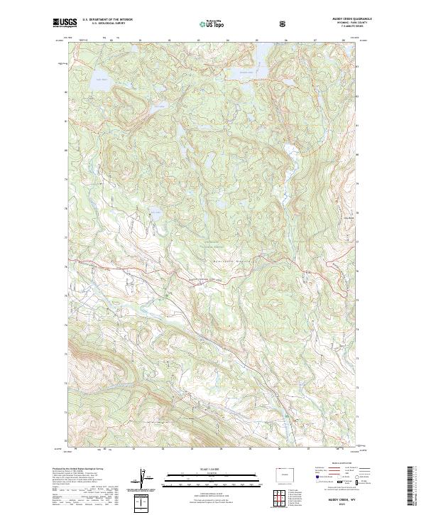
2023 Map of Muddy Creek
USGS Topo · Published 2023About this map
Shoshone National Forest encompasses the high-altitude terrain of the Beartooth Mountains in this 2023 survey of Park County. The landscape is defined by its glacial hydrology, featuring a network of alpine waters including Lake Reno, Granite Lake, and Lily Lake. The southern portion of the sheet is dominated by the Clarks Fork Yellowstone River corridor, where modern infrastructure meets historical routes. The Beartooth National Scenic Byway winds across the center, providing access to the Absaroka-Beartooth Wilderness and the North Absaroka Wilderness. For those tracing local land use and transportation history, the presence of the Old Cooke City Rd alongside modern forest access trails like the Clay Butte Trl reveals the evolution of mountain passage in this part of Wyoming. Further east, Clay Butte serves as a prominent landmark overlooking the high lakes region.
Find a feature on this map
35 named features on this map. Tap any name to fly to it.
Don’t see what you’re looking for? This feature index may not catch every label — zoom into the map to look around manually.
Map Details
Editions of this 2023 Muddy Creek Map
This is the sole edition of this map. No revisions or reprints were ever made.
Other maps of this area

1896 · Crandall Creek
USGS Topo · 1:125,000

1898 · Granite Mountain District
USGS Topo · 1:125,000

1899 · Crandall
USGS Topo · 1:125,000

1954 · Billings
USGS Topo · 1:250,000

1955 · Cody
USGS Topo · 1:250,000

1956 · Alpine
USGS Topo · 1:62,500

1956 · Beartooth Butte
USGS Topo · 1:62,500

1956 · Cooke City
USGS Topo · 1:62,500

1956 · Pilot Peak
USGS Topo · 1:62,500

1957 · Billings
USGS Topo · 1:250,000