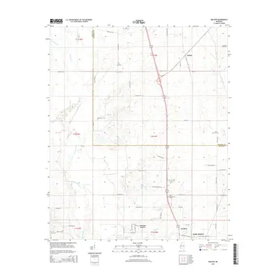
2015 Map of Muldon
USGS Topo · Published 2015About this map
Chuquatonchee Creek and Houlka Creek converge in this rural landscape at the intersection of Clay and Monroe counties, defining a region characterized by dispersed settlements and family-named landmarks. The village of Muldon sits in the northeastern corner, serving as a focal point near the crossing of Miller Road and Sykes Road. To the south, the expansion of West Point is evident in developments like Northgate and Oakridge Estates, alongside commemorative sites such as West Point Memorial Gardens. Genealogy researchers can find several historic burial grounds scattered throughout the township lines, including Paine Chapel Cemetery, Mountain Union Cemetery, and the Le Noir Cemetery located near Wilson Hill Road. This geography reflects a persistent agricultural and residential structure along the Chuquatonchee floodplain.
Find a feature on this map
63 named features on this map. Tap any name to fly to it.
Don’t see what you’re looking for? This feature index may not catch every label — zoom into the map to look around manually.
Map Details
Editions of this 2015 Muldon Map
This is the sole edition of this map. No revisions or reprints were ever made.
Other maps of this area

1953 · West Point
USGS Topo · 1:250,000

1958 · West Point
USGS Topo · 1:250,000

1959 · West Point
USGS Topo · 1:62,500

1959 · Van Vleet
USGS Topo · 1:62,500

1959 · Pheba
USGS Topo · 1:62,500

1963 · West Point
USGS Topo · 1:250,000

1966 · Aberdeen
USGS Topo · 1:24,000

1966 · Prairie
USGS Topo · 1:24,000

1982 · West Point
USGS Topo · 1:100,000

1984 · West Point
USGS Topo · 1:250,000