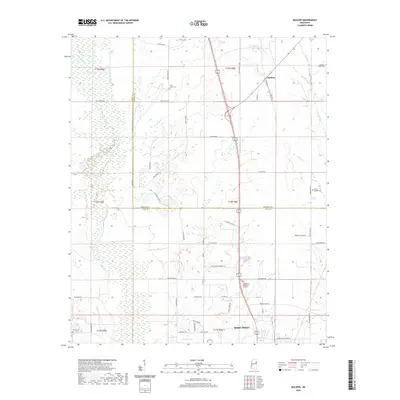
2020 Map of Muldon
USGS Topo · Published 2020About this map
The city of West Point anchors the southern portion of this landscape, where the northern edge of the municipality transitions into the agricultural fields and wetlands of the Clay and Monroe County border. The settlement of Muldon sits to the northeast, marking a point of interest for those tracing the rural development of this region. The terrain is defined by a complex network of waterways, including the winding Chuquatonchee Creek and its bottomlands, which dominate the western half of the map. Smaller tributaries like McGee Creek and Town Creek carve through the eastern sections, illustrating the natural drainage patterns that have historically dictated land use and road placement. For genealogists, the map is particularly rich in family and community landmarks, featuring numerous burial sites such as Le Noir Cemetery, Third Union Cemetery, and the Payne Chapel Cemetery. These sites, along with rural routes like Old Magnolia Highway, provide essential context for understanding the 21st-century footprint of this Mississippi river basin area.
Find a feature on this map
59 named features on this map. Tap any name to fly to it.
Don’t see what you’re looking for? This feature index may not catch every label — zoom into the map to look around manually.
Map Details
Editions of this 2020 Muldon Map
This is the sole edition of this map. No revisions or reprints were ever made.
Other maps of this area

1953 · West Point
USGS Topo · 1:250,000

1958 · West Point
USGS Topo · 1:250,000

1959 · West Point
USGS Topo · 1:62,500

1959 · Van Vleet
USGS Topo · 1:62,500

1959 · Pheba
USGS Topo · 1:62,500

1963 · West Point
USGS Topo · 1:250,000

1966 · Aberdeen
USGS Topo · 1:24,000

1966 · Prairie
USGS Topo · 1:24,000

1982 · West Point
USGS Topo · 1:100,000

1984 · West Point
USGS Topo · 1:250,000